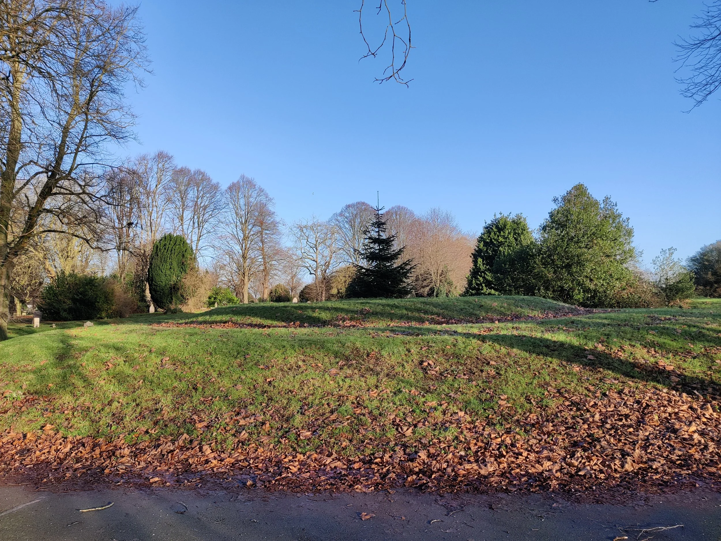
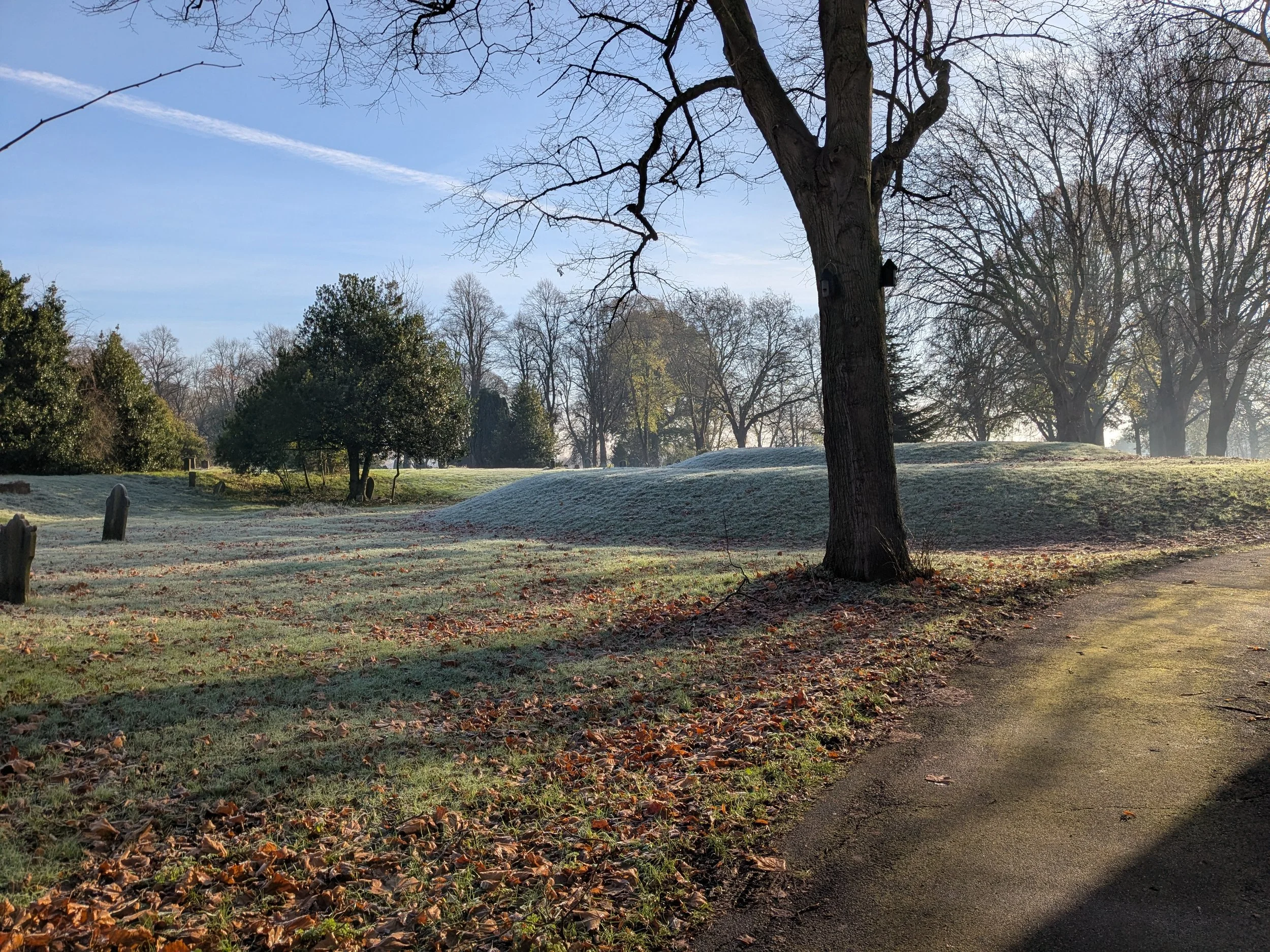
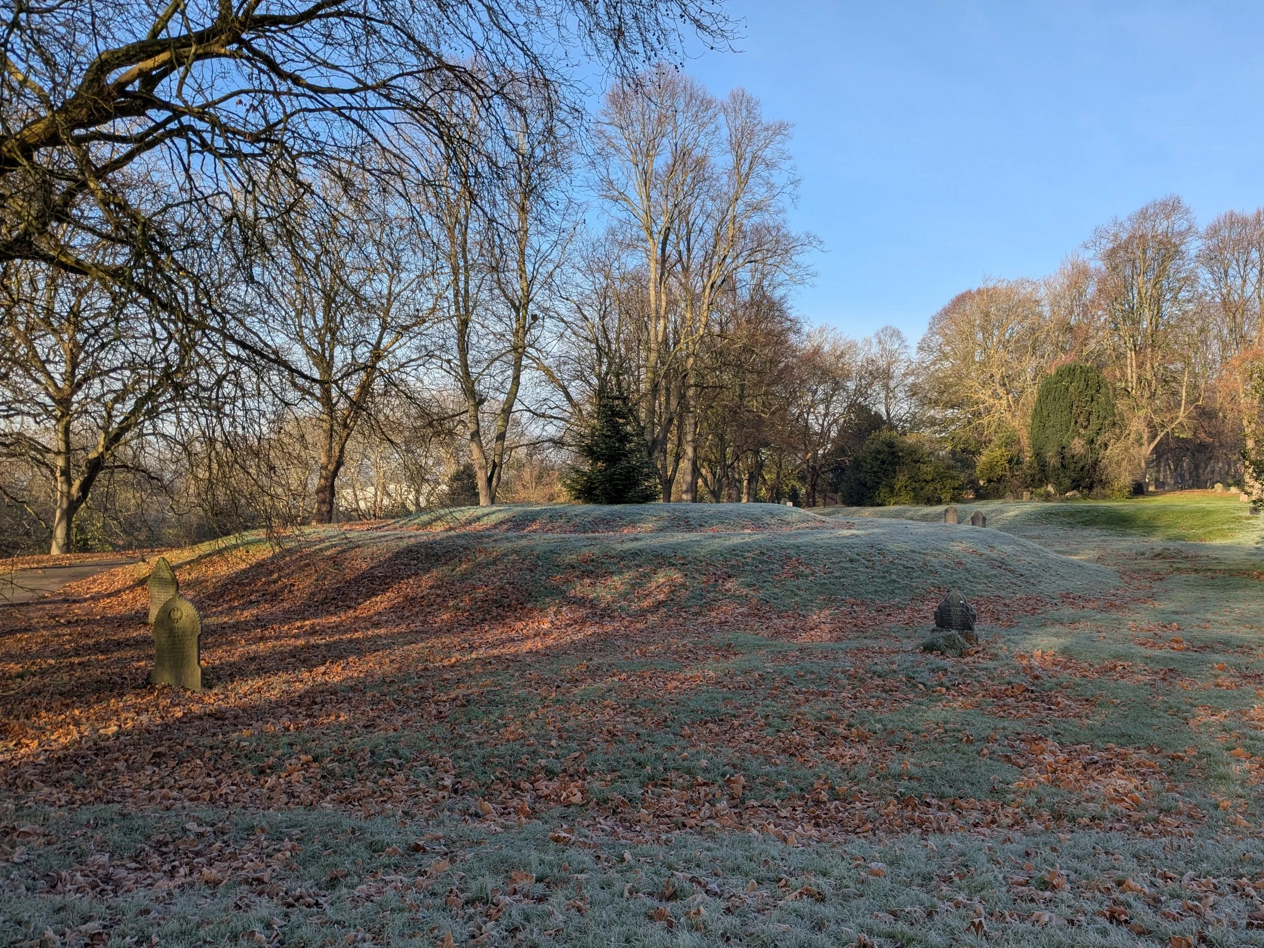
The Mound and Catacombs?
///broke.statue.spill
When Mr Barron, the head gardener at Elvaston Castle, laid out the cemetery grounds, he intended to make the catacombs a feature of the ground.
“He considered that if placed on the brow of the hill they would have been an attractive feature from the railway, and would be more distinguished still when the plantation of trees grew up around them”.
A mound still exists in the position indicated on Ordnance survey maps from around 1880, this is in line with the central axis of the original design that extends from the Church of England chapel down to what was the Derby Canal.

Although plans for the catacombs were drawn up in 1856 at a cost of £195 15s 0d, (£195.75) no catacombs have been used in the Cemetery. The Burial Charges pamphlet from that time shows there were five classes of grave. The cost of a first-class grave could be as much as £27 6s 0d (£27.30) whilst the cost of a 5th class grave was 4s 6d (22½p). Although prices were quoted for burial in the catacombs, there were never any interments. In 1871 the decision was made to combine the 4th and 5th class graves and remove the price for catacombs. At this point, all reference to catacombs was removed from the table of fees.

An extract from the official listing of the Cemetery contains the following text. “The route from the Anglican chapel, part of which is now no longer in use, is directly aligned with a grass mound which forms a central feature to the terrace route. The large, raised, stepped grass mound is set in a wide recessed dip located 350m south-south-west of the main entrance. The OS map of 1882/3 suggests that a single tree specimen stood at the top of the mound and that retaining walls supported the raised promenade; these are no longer visible. A path from the terraced promenade proceeds towards a broad flight of stone steps, 10m south-west of the raised mound, leading down to an area sloping fairly steeply to the south-west boundary. This is now an area of low-level maintenance with few headstones. A central path, no longer evident, formerly led down from the steps to the south-west lined by a wide avenue of trees, creating a strong axial relationship with the raised mound. The path then divided into two symmetrically aligned paths, no longer evident, which connected back to either end of the terraced promenade. A short route connecting to the canal, which may have been used to provide access for building materials, for the delivery of memorial stones or even for funeral parties, is also now gone. An avenue of mature London plane trees is all that remains from the earlier layout in this part of the cemetery (OS 1882/3)”.
The mound is still an identifiable feature in the cemetery today, one day we hope to discover if any solid structure still remains below the grass.
What is known is that no burials have taken place on the Mound.
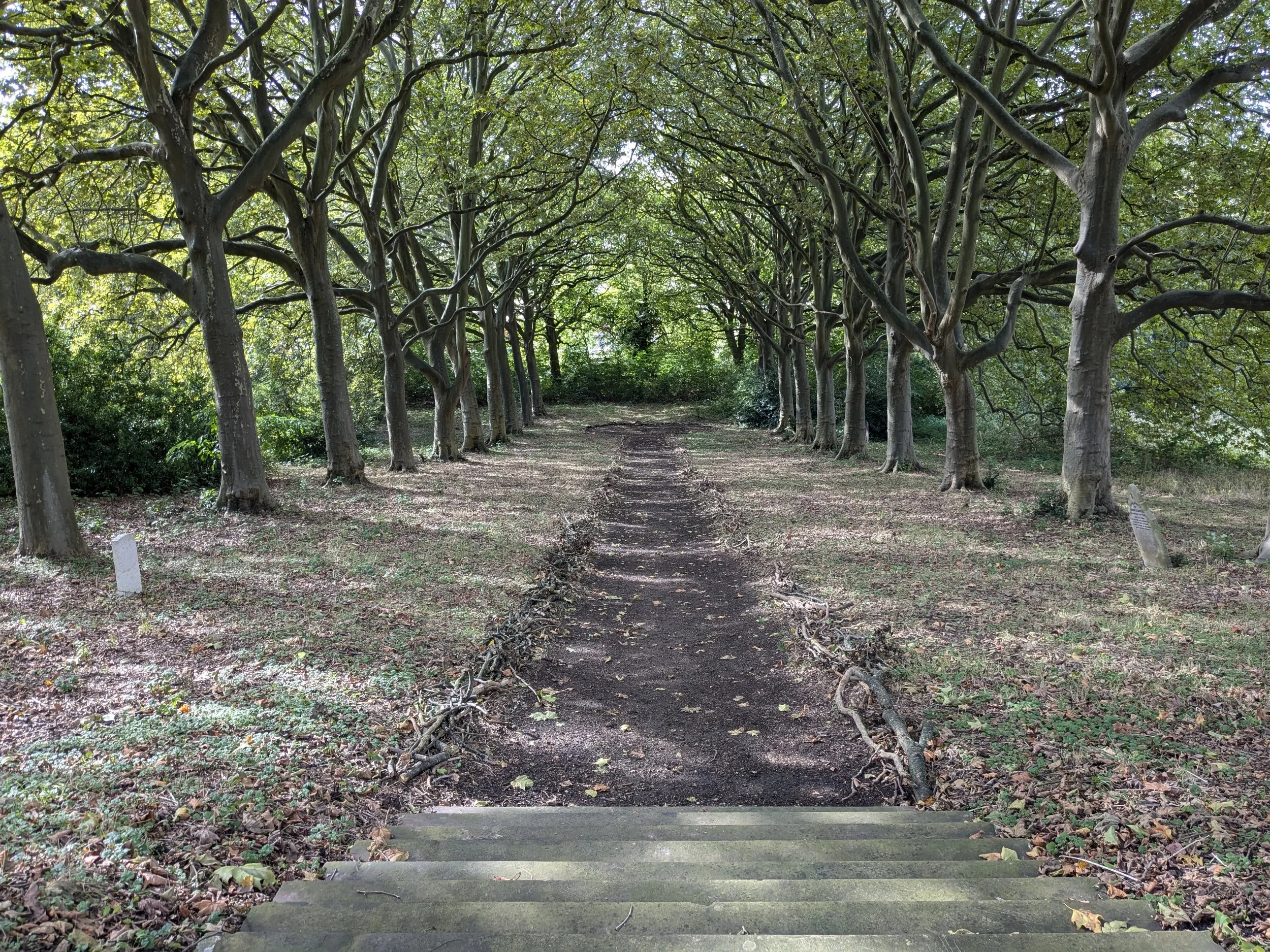
The Steps
///cloud.keep.pouch
In the early 1850's some of the materials for construction were brought along the Derby Canal which formed the southern boundary of the cemetery. The boundary was marked by iron railings which still separate the cemetery from the A52, Brian Clough Way.
Some coffins for burial also arrived by canal boat and a wide set of steps that once led from a landing stage can still be seen. Using this route into the cemetery avoided the toll payable on the main Nottingham Road.