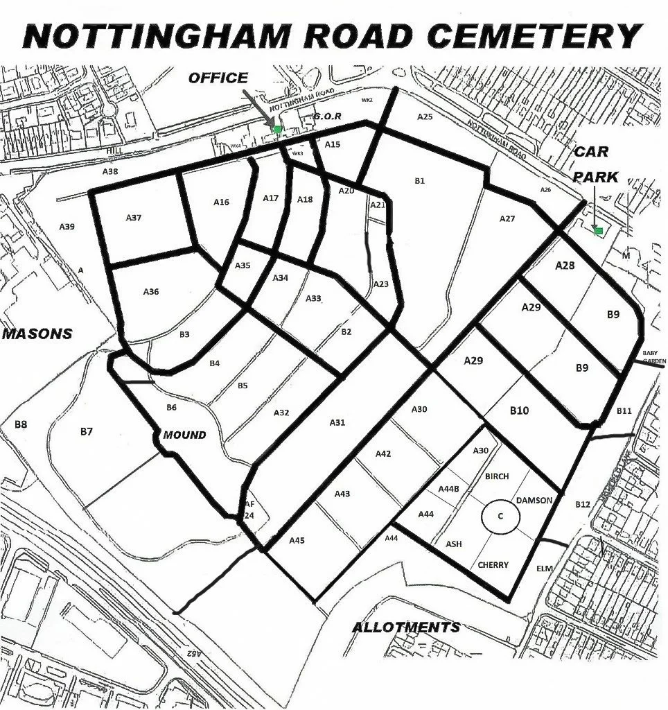
Map of Modern zone numbers for Nottingham Road Cemetery main site.

Click below for fully detailed maps showing individual plot numbers.

All maps orientated with Nottingham Road at the top of the page.

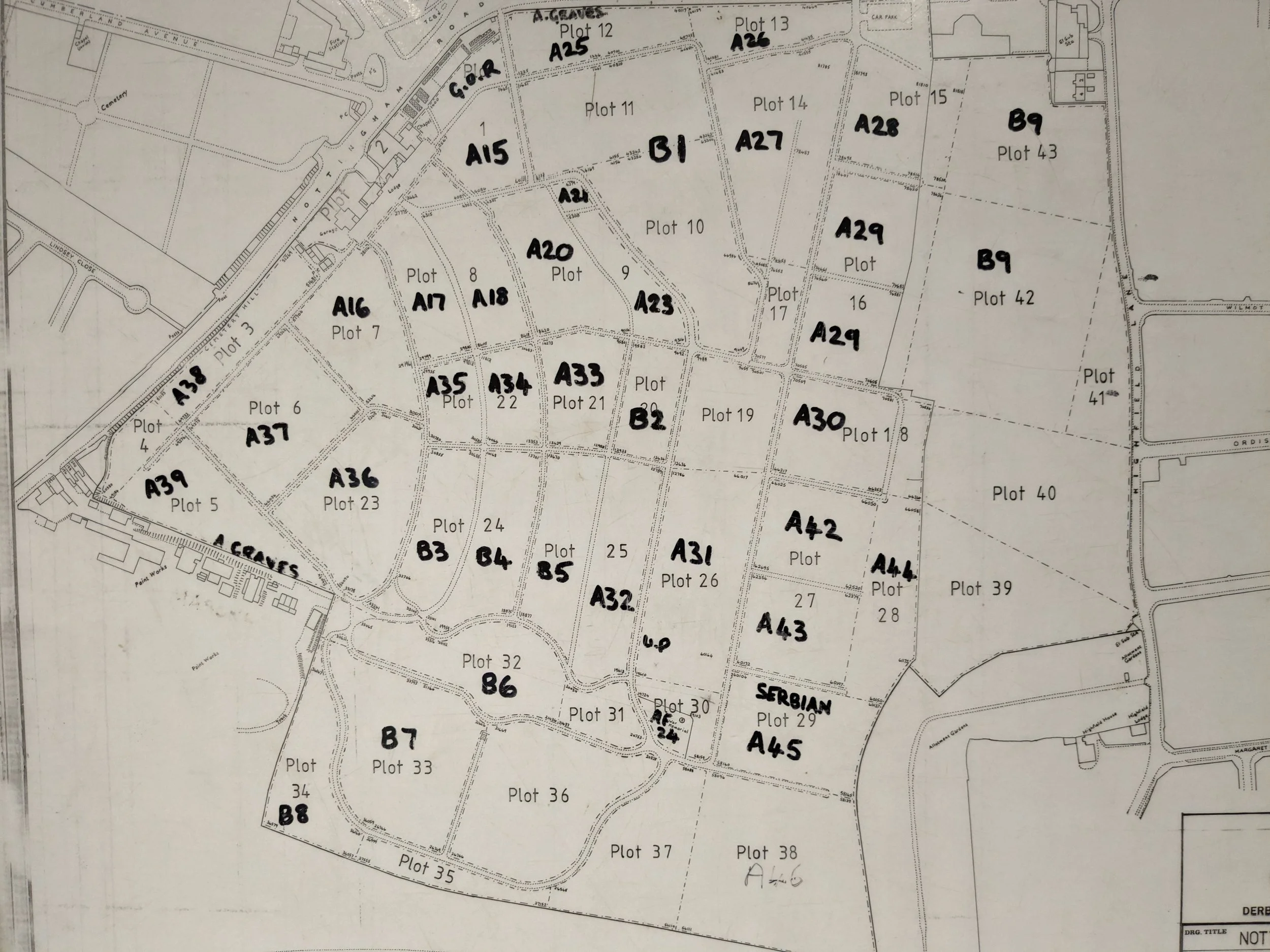
Plot 01 - A15, WK2
Plot 02 - WK4
Plot 03 - A38 East
Plot 04 - A38 West
Plot 05 - A39
Plot 06 - A37
Plot 07 - A16
Plot 08 - A17, A18, WK3
Plot 09 - A20, A21, A23
Plot 10 - B1 South
Plot 11 - B1 North
Plot 12 - A25
Plot 13 - A26
Plot 14 - A27
Plot 15 - A28
Plot 16 - A29
Plot 17 - A27 South
Plot 18 - A30
Plot 19 - A31 North
Plot 20 - B2
Plot 21 - A33
Plot 22 - A34, A35
Plot 23 - A36
Plot 24 - B3, B4
Plot 25 - B5, A32
Plot 26 - A31 South
Plot 27 - A42, A43
Plot 28 - A44
Plot 29 - A45
Plot 30 - A31 South, AF24
Plot 31 - B6 East
Plot 32 - B6 West
Plot 33 - B7 West
Plot 34 - B8 West
Plot 35 - B8 Centre
Plot 36 - B7 East
Plot 37 - B8 East
Plot 38 - A46

Click on icons to open downloadable versions.

Conversion of Modern Zones to original Plot areas in Nottingham Road Cemetery main site.

Map of zones for Nottingham Road Cemetery Fire Station side.

Detailed plot maps for the fire station side are not yet available.

Plot 43 - B9 North